Support our educational content for free when you purchase through links on our site. Learn more
🚁 Drone Industry Trends and Opportunities (2026)

The biggest drone industry trends and opportunities in 2026 are moving beyond aircraft sales: commercial success is increasingly tied to AI-powered autonomy, BVLOS operations, specialized sensors, drone data, recurring inspections, delivery networks, and counter-UAS security. Our recommendation is straightforward: build expertise around a costly business problem, then use the drone as the tool—not the product.
We’ve seen this shift firsthand. A client once asked us for “a few aerial photos” of a construction site; after the first flight, they wanted a 3D model, progress comparison, stockpile estimate, and repeat monthly inspections. The aircraft stayed the same, but the value multiplied when the imagery became decision-ready information.
The opportunity is real, but the hype needs a seat belt. Forecasts vary because some reports count only commercial aircraft while others include defense, software, services, delivery, and advanced air mobility. The direction is consistent: organizations want safer inspections, faster mapping, better environmental intelligence, and automation that can operate repeatedly under clear safety rules.
Key Takeaways
- Commercial drone services offer stronger opportunities than basic aerial photography. Mapping, infrastructure inspection, agriculture, energy, public safety, and environmental monitoring can create repeat business.
- AI will assist pilots rather than instantly replace them. Human oversight, safety judgment, data validation, and domain expertise remain essential.
- BVLOS operations are a major growth catalyst. Routine beyond-visual-line-of-sight flights could expand delivery, infrastructure monitoring, security, and drone-in-a-box deployments.
- Drone data is often more valuable than drone hardware. LiDAR, thermal, multispectral, and high-resolution imaging become commercially useful when transformed into reports, measurements, and maintenance decisions.
- Drone-as-a-Service is a practical business model. Clients can outsource aircraft, pilots, compliance, processing, maintenance, and reporting through recurring contracts.
- Regulatory knowledge is a competitive advantage. FAA rules, Remote ID, EASA categories, privacy requirements, insurance, and airspace restrictions shape every serious operation.
- The strongest careers combine flight skills with another discipline. GIS, photogrametry, thermography, agriculture, cybersecurity, robotics, AI, and inspection expertise can dramatically increase earning potential.
- Delivery drones and advanced air mobility have high upside but higher uncertainty. Medical logistics and controlled industrial routes are likely to mature before widespread doorstep delivery.
- Sustainable growth depends on trust. Privacy protection, cybersecurity, wildlife awareness, safe operations, transparent policies, and reliable reporting will determine public acceptance.
- The winning question is not “Which drone should I buy?” Ask instead: “Which expensive, dangerous, repetitive, or inaccessible problem can aerial technology solve better?”
Table of Contents
-
🛰️ From Remote-Controled Aircraft to Autonomous Aerial Systems: The Drone Industry’s Evolution
-
Commercial Drones Versus Consumer Drones: Where Is Demand Moving?
-
Regional Drone Markets: North America, Europe, Asia-Pacific, and Emerging Economies
-
🚀 Drone Industry Trends 2026 Preview: Technology, Regulations, and Career Opportunities
-
4. Improved Batteries, Hydrogen Power, and Hybrid Propulsion
-
🤖 The Future of Drone Technology: Core Innovations Shaping the Next Decade
-
Autonomous Navigation, Obstacle Avoidance, and Computer Vision
-
Machine Learning for Inspection, Detection, and Predictive Maintenance
-
Payload Innovation: Cameras, LiDAR, Gas Sensors, and Communications Relays
-
Interoperability, Open Architectures, and Drone Fleet Management
-
FAA Rules, Remote ID, Part 107, and BVLOS Waivers in the United States
-
European Union Drone Regulations and EASA Operating Categories
-
UK CAA Rules, Operator Requirements, and Airspace Restrictions
-
International Standards, ICAO Guidance, and Cross-Border Operations
-
Public Safety, National Security, and Supply-Chain Restrictions
-
2. Infrastructure Inspection: Bridges, Roads, Railways, and Dams
-
3. Energy and Utilities: Power Lines, Wind Turbines, Solar Farms, and Pipelines
-
9. Environmental Monitoring, Conservation, and Climate Research
-
13. Telecommunications, Mapping, and Communications Infrastructure
-
💼 Career and Business Opportunities in the 2026 Drone Economy
-
2. Drone Surveyor, Mapping Specialist, and Photogrametry Technician
-
7. Agricultural Drone Operator and Precision Farming Consultant
-
9. Drone Software, Fleet Management, and Data Platform Startup
-
10. Drone Delivery, UAS Logistics, and Autonomous Operations
-
🧭 How to Start a Drone Business and Find Profitable Market Niches
-
Choosing Between Drone Services, Software, Hardware, and Consulting
-
How to Price and Package Drone Services Without Racing to the Bottom
-
📈 Drone Investment Opportunities: Where Capital and Innovation Are Flowing
-
What Investors Should Examine Before Backing a Drone Company
-
🛡️ Best Practices for Safe, Responsible, and Profitable Drone Operations
-
Maintenance Programs, Battery Safety, and Incident Reporting
-
🔮 What Comes After 2026? The Long-Term Drone Industry Forecast
-
🏁 Conclusion: Where the Biggest Drone Industry Opportunities Are Hiding
⚡️ Quick Tips and Facts: Drone Industry Trends at a Glance
If you’re exploring drone industry trends and opportunities, start with one practical truth: the money is moving away from simply selling aircraft and toward data, automation, compliance, specialized sensors, and repeatable services.
At Drone Brands™, we’ve flown drones for aerial adventures, mapping experiments, property footage, and the occasional “why is that seagull so interested?” encounter. The pattern is clear: a drone is only as valuable as the decision its data helps someone make.
For a deeper look at potential ventures, begin with our guide to drone business ideas. Then compare that advice with the Pilot Institute drone statistics report, which projects strong long-term growth while also warning that regulation, supply chains, and workforce skills will determine who actually benefits.
📌 15 fast facts about the drone economy
| # | Fact | Why it matters |
|---|---|---|
| 1 | Commercial drone use is expanding faster than hobby flying in many forecasts. | Enterprise buyers want measurable outcomes, not just impressive footage. |
| 2 | Mapping and surveying remain among the strongest commercial applications. | Pilots who understand photogrametry, GIS, and reporting can charge for expertise rather than flight time. |
| 3 | Energy and utilities use drones for power-line, pipeline, wind-turbine, and solar-farm inspections. | Drones reduce exposure to heights, traffic, electrical hazards, and difficult terrain. |
| 4 | BVLOS, or beyond visual line of sight, is central to delivery and long-range inspection growth. | Routine BVLOS could turn one pilot into a supervisor of multiple aircraft. |
| 5 | AI now assists with route planning, object detection, defect identification, and data processing. | Manual flying remains useful, but AI oversight is becoming equally valuable. |
| 6 | LiDAR, thermal, multispectral, hyperspectral, and gas-detection payloads are opening specialist niches. | The best opportunities often involve interpreting sensor data, not merely collecting it. |
| 7 | Drone-as-a-Service lets clients outsource hardware, pilots, processing, and compliance. | Recurring contracts are usually more stable than one-off aerial shoots. |
| 8 | Delivery drones are moving from demonstrations toward operational networks. | Medical logistics and remote communities may mature before suburban retail delivery. |
| 9 | Counter-drone systems are growing alongside legitimate drone operations. | More aircraft in the sky create demand for detection, identification, and mitigation. |
| 10 | UTM and U-space systems are being developed to coordinate low-altitude traffic. | Airspace awareness will become a core operational skill. |
| 11 | Construction firms use drones for progress tracking, stockpile calculations, and 3D models. | Faster site intelligence can affect scheduling, purchasing, and dispute resolution. |
| 12 | Agriculture uses multispectral and thermal imaging for crop stress and irrigation analysis. | Drone services become valuable when they lead to a specific farm action. |
| 13 | Advanced air mobility connects drones with eVTOL aircraft and autonomous passenger transport. | The industry may expand from small UAS into broader aviation infrastructure. |
| 14 | Hardware is important, but software and services capture much of the recurring value. | Fleet management and analytics can scale more easily than pilot hours. |
| 15 | Regulatory literacy is a business advantage. | A technically brilliant mission that violates airspace rules is still a failed mission. |
📊 The big picture in one sentence
The drone sector is shifting from “Can it fly?” to “Can it operate safely, repeatedly, autonomously, and produce an actionable result?”
That shift explains why forecasts differ so widely. One market report may count aircraft sales, another may include software, defense, services, delivery, or advanced air mobility. For example, The Drone U highlights forecasts of a global commercial market rising from $38.2 billion in 2025 to $189.9 billion by 2034, while Commercial UAV News cites a broader projection of $54.6 billion by 2030. These figures are not automatically contradictory; they may use different definitions, base years, currencies, and segments.
Our advice: trust the direction of travel more than any single headline number. Commercial adoption, autonomy, data services, infrastructure inspection, logistics, and counter-UAS are all expanding, but the exact market size depends on what the researcher counts.
🎯 Fast takeaways for pilots, founders, and investors
- Pilots: add GIS, photogrametry, thermal imaging, or inspection reporting to your flight skills.
- Business owners: sell recurring monitoring and decision-ready reports instead of isolated aerial footage.
- Investors: inspect regulation, customer retention, hardware margins, cybersecurity, and supply-chain exposure.
- Employers: look for people who can combine aviation safety with data interpretation.
- Hobbyists: consumer drones remain a gateway into mapping, filmmaking, FPV, and public-safety technology.
- Manufacturers: reliability, repairability, secure software, and payload compatibility may matter more than another minor camera upgrade.
- Regulators: scalable BVLOS rules and clear safety standards could unlock major investment, but rushed approvals could damage public trust.
🧭 The opportunity filter we use at Drone Brands™
When someone asks us whether a drone idea is worth pursuing, we run it through five questions:
- Does the drone solve a costly, dangerous, slow, or inaccessible task?
- Can the service be repeated monthly, quarterly, or after a defined event?
- Can the result be measured in time saved, risk reduced, revenue gained, or damage prevented?
- Can the operation comply with current and future aviation rules?
- Can software or workflow automation increase output without multiplying staff?
If the answer is “yes” to at least four, there may be a business hiding under the propellers.
🗺️ Quick opportunity map
| Opportunity | Buyer | Useful drone capability | Revenue potential |
|---|---|---|---|
| Roof and solar inspection | Roofing firms, solar installers, insurers | RGB, thermal, automated reporting | Repeat inspections |
| Construction progress | General contractors, developers | Orthomosaics, 3D models, site documentation | Recurring monthly work |
| Power-line inspection | Utilities, engineering firms | Zoom, thermal, LiDAR, BVLOS systems | Large enterprise contracts |
| Crop scouting | Farms, agronomists | Multispectral, thermal, NDVI | Seasonal or subscription |
| Stockpile measurement | Quarries, mines, construction companies | Photogrametry, LiDAR | Repeat volume calculations |
| Search and rescue | Fire departments, police, rescue teams | Thermal, zoom, rapid deployment | Public-sector contracts |
| Delivery logistics | Hospitals, retailers, industrial sites | Autonomous routing, payload systems | Network-scale operations |
| Counter-UAS | Airports, prisons, venues, infrastructure owners | RF, radar, EO/IR, analytics | Security programs |
| Aerial adventures and media | Tourism, events, filmmakers | Stabilized cameras, FPV, creative flight | Project and licensing fees |
🛰️ From Remote-Controled Aircraft to Autonomous Aerial Systems: The Drone Industry’s Evolution
A brief history of commercial and consumer drones
Drones did not appear fully formed with obstacle avoidance, GPS, and a cinematic camera mounted underneath. Early unmanned aircraft were expensive, specialized, and generally associated with military reconnaissance. Over time, improvements in batteries, brushless motors, satellite positioning, compact cameras, processors, and wireless communication made small drones accessible to consumers and commercial operators.
The consumer boom accelerated when companies such as DJI, Autel Robotics, and Parot packaged advanced flight assistance into relatively approachable aircraft. A modern camera drone can hold position, return home, follow a subject, avoid obstacles, and produce stabilized 4K footage. That would have sounded like science fiction to many early remote pilots.
The commercial market then added a second layer: drones became measurement tools. A camera was no longer just recording a roof or landscape. It was collecting images for an orthomosaic, thermal evidence for a maintenance decision, or point-cloud data for a volumetric calculation.
How military, consumer, and enterprise markets converged
The drone ecosystem now contains several overlapping families:
| Segment | Typical aircraft | Primary value |
|---|---|---|
| Consumer photography | DJI Mini 4 Pro, DJI Air 3S, Autel EVO Nano+ | Recreation, travel, social content |
| FPV and aerial adventure | DJI Avata 2, custom FPV builds, iFlight systems | Immersive flight, action footage, racing |
| Professional imaging | DJI Mavic 3 Enterprise, Autel EVO Max series | Inspection, mapping, public safety |
| Heavy-lift and industrial VTOL | JOUAV, Harris Aerial, FlyingBasket | Endurance, cargo, remote operations |
| Defense and security | AeroVironment, Shield AI, General Atomics | Reconaissance, surveillance, tactical missions |
| Delivery systems | Zipline, Wing, Maternet | Medical, retail, and logistics delivery |
| Counter-UAS | Dedrone, DroneShield, Echodyne | Detection, classification, and site protection |
The crossover is especially visible in sensors and autonomy. A thermal camera developed for industrial inspection can support wildfire response. A computer-vision system trained to recognize infrastructure defects may also help an autonomous drone avoid obstacles. A rugged communications link designed for public safety can influence commercial fleet design.
That cross-integration was also emphasized in the featured video, which describes drones as “data hubs, AI platforms, and invaluable business tools” rather than flying cameras. Its figures differ from newer forecasts, but its central argument remains useful: the most important innovation is not the aircraft alone. It is the combination of airframe + sensor + software + workflow.
Why drone adoption is accelerating now
Several forces are arriving at the same time:
- Sensors are getting smaller and more capable.
- Cloud and edge computing reduce processing delays.
- AI can classify objects and prioritize anomalies.
- Labor shortages make automated inspection attractive.
- Safety rules are gradually becoming more structured.
- Organizations have more pressure to document assets and environmental conditions.
- Businesses increasingly expect digital twins, dashboards, and evidence rather than raw media files.
We saw this transition firsthand during an aerial mapping project. The client initially asked for “some drone photos.” After seeing the first set, they wanted roof measurements, a progress comparison, and a map they could share with a remote project manager. The aircraft had not changed. The question being asked of the data had.
That is the commercial opportunity in miniature.
🔭 The Drone Industry Outlook for 2026 and Beyond
What is driving global drone market growth?
Forecasts should be read with a healthy pinch of propeller wash. Different research firms define the drone market differently:
- Some include only drone hardware.
- Some include software, services, training, maintenance, and payloads.
- Some include military systems.
- Some include eVTOL aircraft and advanced air mobility.
- Some focus on commercial drones while excluding consumer products.
The Pilot Institute statistics overview cites a forecast of the global drone market reaching $209.91 billion by 2035, with a 16.77% CAGR from 2026 to 2035. The same source describes commercial use as showing particularly robust momentum.
By contrast, Commercial UAV News reports a projection of $54.6 billion by 2030 and identifies commercial drone growth at 7.7% CAGR. That lower figure may reflect a narrower market definition.
| Forecast style | What it may include | How to interpret it |
|---|---|---|
| Narrow commercial UAV market | Enterprise aircraft and selected services | Useful for near-term procurement |
| Broad drone ecosystem | Hardware, software, services, defense, delivery | Useful for total economic opportunity |
| Advanced air mobility forecast | eVTOL and passenger aircraft | More speculative and certification-dependent |
| Consumer drone forecast | Camera drones, FPV, accessories | Useful for retail and media demand |
| Drone-services forecast | Mapping, inspection, analytics, DaaS | Most relevant to service entrepreneurs |
What can we trust? We trust overlapping trends:
- Commercial workflows are becoming repeatable.
- Data processing is becoming more valuable.
- BVLOS remains a major unlock.
- Inspection and mapping are established use cases.
- Delivery and eVTOL have high upside but greater regulatory risk.
- AI will change job descriptions, not eliminate the need for safety oversight overnight.
Commercial drones versus consumer drones: where is demand moving?
Consumer drones remain important. They build the pilot base, fund research and development, and introduce new users to aerial imaging. Products such as the DJI Mini 4 Pro, DJI Air 3S, and DJI Avata 2 demonstrate how much flight assistance is now packed into small systems.
However, the strongest recurring opportunities are generally in commercial operations:
| Consumer demand | Commercial demand |
|---|---|
| Travel footage | Asset inspection |
| Social media content | Mapping and measurement |
| Recreation | Safety and emergency response |
| FPV flying | Infrastructure monitoring |
| Aerial adventures | Agricultural intelligence |
| Real estate imagery | Insurance documentation |
| Personal exploration | Fleet automation |
A consumer pilot might value compact size, quiet operation, and image quality. An enterprise customer may care more about:
- Fleet uptime
- Evidence quality
- Data security
- Audit trails
- Payload compatibility
- Training records
- Insurance
- Regulatory compliance
- Integration with existing GIS, CAD, or asset-management software
That is why our commercial drone guides focus less on megapixels and more on the entire operational chain.
Regional drone markets
North America
North America has a large commercial customer base, strong investment, mature aviation infrastructure, and significant demand from energy, construction, public safety, defense, and insurance.
The United States also has an active regulatory debate around automated BVLOS operations. The Federal Aviation Administration continues to oversee Part 107, Remote ID, airspace authorizations, and waiver processes. Operators should verify current requirements directly because proposed rules and compliance dates can change.
Europe
The European Union is building a more harmonized framework through EASA, including operating categories and U-space development. Europe’s emphasis on risk-based operations, privacy, and cross-border consistency could support professional services, though compliance can be demanding.
Asia-Pacific
Asia-Pacific includes major manufacturing centers, large agricultural markets, dense urban areas, and rapidly growing logistics systems. China’s manufacturing scale strongly influences global supply chains, while Japan, Singapore, South Korea, India, and Australia are developing their own commercial and regulatory pathways.
Middle East and Africa
Infrastructure inspection, construction, security, mining, and environmental monitoring are particularly promising. Large projects and remote terrain can make aerial data valuable, but operators must understand local aviation authorities, import rules, security restrictions, and community expectations.
Drone industry investment, funding, and mergers
Capital is flowing into more than aircraft manufacturers. The broader investment map includes:
- Autonomy software
- Computer vision
- Battery and hydrogen systems
- Secure communications
- Drone-in-a-box stations
- Payloads
- UTM and USS platforms
- Counter-UAS systems
- Fleet management
- Data analytics
- Delivery networks
- eVTOL infrastructure
- Maintenance and training
A useful investor question is: Does this company sell a device, or does it own a workflow?
Hardware can be copied, commoditized, or restricted by supply-chain decisions. A software platform embedded inspection, compliance, or asset-management processes may create stronger customer retention.
🚀 Drone Industry Trends 2026 Preview: Technology, Regulations, and Career Opportunities
1. Artificial intelligence and autonomous flight
AI is moving from laboratory demonstrations into daily operational support. As The Drone U puts it, “AI tools now support daily operations, not just testing.”
Current AI-assisted tasks include:
- Route planning
- Obstacle detection
- Landing-zone identification
- Object tracking
- Defect recognition
- Crop-stress classification
- Thermal anomaly detection
- Image quality screening
- Automated report generation
- Predictive maintenance
- Mission debriefing
The catch? AI can confidently misclassify a shadow, glare, bird, reflection, or heat source. We once reviewed a thermal image where a warm patch looked suspicious until the site manager explained that it was a recently opened equipment cabinet. The algorithm was not “wrong” in a technical sense; it simply lacked context.
Best practice: treat AI as a fast assistant, not the final authority.
2. Beyond visual line of sight operations
BVLOS means operating beyond the remote pilot’s direct visual range. It is essential for:
- Long power-line inspections
- Pipeline monitoring
- Wide-area agriculture
- Delivery networks
- Search operations over large regions
- Offshore infrastructure
- Autonomous security patrols
BVLOS requires more than a powerful radio. A safe operation may need:
- Detect-and-avoid capability
- Reliable command-and-control links
- Remote identification
- Geofencing and airspace awareness
- Lost-link procedures
- Weather monitoring
- Ground risk assessment
- Emergency landing planning
- Trained supervisors
- Documented maintenance
The FAA’s proposed Part 108 framework has attracted attention because standardized BVLOS rules could reduce dependence on case-by-case waivers. Until applicable rules are finalized and effective, U.S. operators should follow current FAA requirements and avoid treating proposed policy as permission.
3. Drone-in-a-box and remote operations centers
A drone-in-a-box system combines:
- A dock or shelter
- Automated battery charging
- Weather protection
- Mission software
- Remote communications
- Health monitoring
- Launch and recovery procedures
Potential uses include:
- Perimeter security
- Construction monitoring
- Solar-farm inspection
- Quarry surveillance
- Emergency response
- Industrial-site patrols
Companies such as DJI Enterprise, Skydio, and Percepto illustrate different approaches to enterprise autonomy and remote operations.
The business model changes dramatically. Instead of sending a pilot to capture one inspection, an organization can schedule routine missions, flag anomalies, and dispatch a human only when something needs investigation.
4. Improved batteries, hydrogen power, and hybrid propulsion
Lithium-polymer batteries remain dominant for small electric multirotors, but endurance is limited by payload, temperature, wind, and flight style. Longer missions are encouraging experimentation with:
- Hydrogen fuel cells
- Hybrid-electric systems
- Gas-electric propulsion
- Swappable batteries
- Solar-assisted fixed-wing designs
- Tethered power
- High-energy-density battery chemistries
Hydrogen systems may offer longer endurance, but they introduce storage, infrastructure, safety, and maintenance considerations. A six-hour endurance claim is useful only if the aircraft can operate reliably in the weather, carry the required sensor, transmit the data, and be maintained by a real team.
5. Drone swarms and collaborative aerial robotics
A swarm involves multiple aircraft coordinating toward a shared objective. Civilian applications are still more limited than defense demonstrations, but possible uses include:
- Large-area environmental surveys
- Search patterns
- Event safety
- Warehouse or yard monitoring
- Communications relay
- Disaster assessment
- Coordinated light shows
- Agricultural scouting
The technical challenge is not simply keeping drones from colliding. It is assigning tasks, preserving communications, handling failures, and proving that the entire system behaves safely under unexpected conditions.
6. Counter-drone technology and airspace security
Every expanding technology creates a protection market. Counter-UAS systems may use:
- RF detection
- Radar
- Electro-optical cameras
- Infrared sensors
- Acoustic arrays
- AI classification
- Remote identification data
Vendors such as DroneShield, Dedrone, and Echodyne operate in parts of this growing ecosystem.
Counter-drone work is legally sensitive. Detecting an aircraft is not the same as being authorized to disrupt it. Jamming, spoofing, seizure, or kinetic mitigation may be restricted to specific government or security authorities.
7. Digital twins, 3D mapping, and geospatial intelligence
A drone survey can produce:
- Orthomosaics
- Digital elevation models
- Digital surface models
- Point clouds
- 3D meshes
- Contour maps
- Volumetric calculations
- Progress comparisons
Platforms such as Pix4D, DroneDeploy, and Esri ArcGIS help convert imagery into usable spatial information.
A digital twin becomes valuable when it connects a model to:
- Asset IDs
- Maintenance records
- Construction schedules
- Sensor readings
- Change detection
- Work orders
- Historical comparisons
A pretty 3D model is nice. A model that tells a facilities manager which asset needs attention is much nicer.
8. Thermal imaging, LiDAR, and multisensor payloads
Different sensors answer different questions:
| Payload | Best for | Common mistake |
|---|---|---|
| RGB camera | Visible documentation, mapping, media | Assuming a sharp image proves a defect |
| Thermal camera | Heat differences, electrical anomalies, water intrusion clues | Treating every warm area as a fault |
| LiDAR | Terrain, vegetation penetration, precise geometry | Ignoring calibration and point density |
| Multispectral | Vegetation vigor, crop stress, index mapping | Confusing an index with a diagnosis |
| Hyperspectral | Material and spectral distinctions | Underestimating processing complexity |
| Gas sensor | Leaks and concentration mapping | Flying without wind and dispersion context |
| Zoom camera | Distant inspection and identification | Losing image stability at high magnification |
The payload does not replace professional interpretation. A thermal drone can locate a possible anomaly, but a qualified technician may still need to confirm the cause.
9. 5G, private networks, and cloud-connected drones
Connected drones may use:
- Wi-Fi
- Cellular networks
- Private LTE
- 5G
- Satellite links
- Mesh networking
- Dedicated command-and-control systems
Connectivity can support real-time video, remote supervision, and fleet coordination. It also creates cybersecurity obligations. A drone transmitting sensitive infrastructure imagery over an insecure connection is not a clever innovation; it is a flying data leak.
10. Sustainable drone design and low-carbon operations
Drones can reduce emissions by replacing some helicopter, truck, tower-climbing, or repeated site visits. They still have environmental costs:
- Battery manufacture
- Electronic waste
- Replacement parts
- Charging electricity
- Shipping
- Noise
- Wildlife disturbance
Sustainable operators should consider:
- Repairable aircraft
- Battery lifecycle tracking
- Efficient mission planning
- Fewer repeat flights
- Renewable charging
- Responsible disposal
- Quiet-propeller options
- Wildlife-sensitive operating windows
11. Delivery drones and urban air mobility
Drone delivery has stronger near-term potential in:
- Medical supplies
- Laboratory samples
- Remote communities
- Industrial campuses
- Emergency parts
- Controlled logistics routes
Retail delivery is attractive but more complex because of noise, landing permissions, weather, public acceptance, and dense airspace.
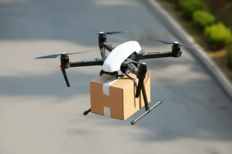
Wing, Zipline, and Maternet show how delivery models can differ. Some use drop mechanisms, some use precise landing, and some focus on medical logistics rather than consumer convenience.
Urban air mobility goes further, involving larger eVTOL aircraft, vertiports, passenger certification, and aviation infrastructure. It may become significant, but we would not use eVTOL projections to estimate the immediate opportunity for a local aerial photographer.
12. Drone-as-a-Service and Robotics-as-a-Service
DaaS packages the difficult parts:
- Aircraft
- Payloads
- Pilots
- Permissions
- Insurance
- Processing
- Reporting
- Maintenance
- Data storage
This model is attractive to customers that need results but do not want to operate an internal fleet. It also creates opportunities for specialists who understand one vertical deeply.
A strong DaaS offer might include:
“Quarterly thermal inspection of your solar assets, anomaly report within 48 hours, geotaged evidence, and maintenance-priority ranking.”
That is more compelling than:
“We fly drones.”
🤖 The Future of Drone Technology: Core Innovations Shaping the Next Decade
Autonomous navigation, obstacle avoidance, and computer vision
Autonomy depends on layered systems:
- Positioning: GNSS, RTK, visual odometry, or indoor markers.
- Perception: Cameras, radar, LiDAR, ultrasonic sensors, or combinations.
- Planning: A route selected according to terrain, obstacles, weather, and mission objectives.
- Control: The aircraft adjusts thrust, attitude, and direction.
- Supervision: A human or remote system monitors status and intervenes when required.
No single sensor is perfect. Cameras struggle in darkness and glare. LiDAR can be affected by reflective or absorptive surfaces. Radar may detect objects without offering detailed classification. Sensor fusion is therefore becoming central.
Machine learning for inspection, detection, and predictive maintenance
AI can help identify:
- Cracks
- Corosion
- Missing bolts
- Vegetation encroachment
- Hot electrical components
- Damaged solar panels
- Roof deterioration
- Standing water
- Crop stress
- Unauthorized activity
The workflow should include a human validation stage:
- Capture consistent imagery.
- Calibrate and geotag the data.
- Run automated detection.
- Review false positives and false negatives.
- Compare with prior inspections.
- Prioritize by severity.
- Send a clear recommendation to the client.
- Record the result for future model improvement.
This is why The Drone U argues that pilots will increasingly spend time “supervising AI, checking results, and ensuring safety.”
Precision positioning: RTK, PK, GNSS, and indoor navigation
For ordinary aerial footage, standard GNSS may be sufficient. For surveying and mapping, accuracy requirements can be far stricter.
- RTK: Corrects positioning in real time through a base station or network.
- PPK: Applies corrections after the flight.
- GNSS: A general term for satellite navigation systems.
- Visual odometry: Estimates movement from camera imagery.
- LiDAR-based navigation: Uses laser returns to understand surroundings.
- UWB or markers: Useful indoor or structured environments.
Accuracy is not just a specification. It depends on ground-control points, camera calibration, flight planning, lighting, terrain, processing settings, and quality checks.
Payload innovation: cameras, LiDAR, gas sensors, and communications relays
Payloads are becoming modular. An enterprise aircraft may carry different tools across the same week:
- RGB camera for documentation
- Thermal sensor for electrical inspection
- LiDAR for terrain mapping
- Multispectral camera for agriculture
- Loudspeaker for public safety
- Spotlight for night operations
- Gas sensor for industrial monitoring
- Radio relay for disaster response
This modularity improves utilization, but it adds training and maintenance requirements. A team must understand not only how to mount a sensor, but also how to interpret its limitations.
Interoperability, open architectures, and drone fleet management
Fleet operators increasingly want to avoid being trapped inside one hardware ecosystem. Useful capabilities include:
- Mission planning
- Pilot and aircraft records
- Battery tracking
- Maintenance alerts
- Remote identification
- Weather integration
- Data export
- Role-based access
- API connections
- Asset-management integration
An open architecture can support growth, but interoperability introduces testing challenges. A flight plan that works perfectly one aircraft may not translate safely to another.
Cybersecurity, encryption, and secure command links
Drone cybersecurity includes:
- Firmware integrity
- Authentication
- Encryption
- Secure application programming interfaces
- Access control
- Device hardening
- Network segmentation
- Patch management
- Data-retention rules
- Incident response
The Cybersecurity and Infrastructure Security Agency provides broader cybersecurity resources relevant to critical infrastructure operators. Organizations handling sensitive mapping, utility, defense, or personal data should involve qualified security professionals rather than relying on a password and optimism.
Human-in-the-loop versus fully autonomous missions
The debate is often framed too simply. Most commercial systems will likely use a spectrum:
| Operating model | Human role | Typical use |
|---|---|---|
| Manual flight | Pilot actively controls aircraft | Media, inspection close-ups |
| Assisted flight | Pilot controls mission with automation | Mapping, repeatable routes |
| Supervised autonomy | Operator monitors aircraft and exceptions | Drone-in-a-box, security |
| One-to-many | One operator supervises several aircraft | Large sites, delivery networks |
| Zero-to-many | Personnel oversee system health and escalation | Highly structured operations |
The safer question is not “Will pilots disappear?” It is “Which parts of the pilot’s job will become supervision, verification, and exception handling?”
🏛️ Regulations Shaping the Drone Ecosystem in 2026
FAA rules, Remote ID, Part 107, and BVLOS waivers in the United States
U.S. commercial operators should begin with the FAA’s official drone rules, not a social-media summary posted beside a discount code.
Common requirements and responsibilities may include:
- Remote pilot certification under Part 107
- Aircraft registration where applicable
- Remote ID compliance
- Airspace authorization
- Operating limitations
- Night-operation requirements
- Avoiding prohibited or restricted areas
- Maintaining visual line of sight unless authorized otherwise
- Yielding to crewed aircraft
- Reporting certain accidents
- Keeping operational records
The proposed Part 108 framework is significant because it could establish a scalable approach to routine BVLOS operations. But proposals are not final rules. Until requirements become effective, operators should not assume a future framework changes current obligations.
European Union drone regulations and EASA operating categories
EASA’s drone regulations generally organize operations into:
- Open category: Lower-risk operations with defined limitations.
- Specific category: Operations requiring authorization, declaration, or a risk assessment.
- Certified category: Higher-risk operations involving certification and stricter oversight.
EU operators should also consider:
- Operator registration
- Remote-pilot competency
- Class-marked aircraft
- Geographic zones
- Data protection
- U-space services
- National implementation differences
UK CAA rules, operator requirements, and airspace restrictions
The UK Civil Aviation Authority provides guidance on registration, competency, operational categories, and permissions. The United Kingdom’s framework should be checked independently rather than assumed to match EASA after Brexit.
International standards, ICAO guidance, and cross-border operations
Cross-border drone work can involve:
- Import and export controls
- Radio-frequency rules
- Insurance
- Pilot recognition
- Data sovereignty
- Privacy laws
- Airspace authorization
- Security restrictions
- Local filming permits
There is no universal “international drone license” that solves every operational problem. Professional operators should build a country-by-country compliance checklist.
Privacy, data protection, and civil liberties
A drone may capture:
- Faces
- License plates
- Private yards
- Industrial layouts
- Employee activity
- Sensitive infrastructure
- Location data
- Thermal signatures
Privacy-by-design practices include:
- Defining the mission purpose
- Minimizing unnecessary capture
- Blurring faces and plates
- Restricting access
- Setting deletion schedules
- Informing affected parties when appropriate
- Avoiding intrusive hovering
- Documenting lawful authority
In Europe, the European Data Protection Board provides guidance relevant to personal data protection. In the United States, privacy obligations may arise from state law, sector-specific rules, contracts, and tort principles.
Safety cases, certification, insurance, and liability
Enterprise customers may request:
- Aviation liability insurance
- Hull coverage
- Pilot qualifications
- Standard operating procedures
- Maintenance records
- Emergency plans
- Risk assessments
- Cybersecurity documentation
- Incident histories
- Vendor certificates
Insurance should match the mission. A basic aerial media assignment has different risks from offshore inspection, delivery, or operations over people.
Public safety, national security, and supply-chain restrictions
Supply-chain policy is increasingly influencing purchasing decisions. Buyers may assess:
- Manufacturer ownership
- Data routing
- Cloud hosting
- Firmware security
- Component origin
- Procurement restrictions
- Government-approved equipment lists
- Cybersecurity certifications
The Blue UAS Framework is one example of a government-oriented approach to trusted systems, though requirements can vary by agency and contract.
🏗️ Industry Sectors Shaping the Future of Drones
1. Construction, surveying, and reality capture
Construction teams use drones for:
- Topographic surveys
- Site progress
- Cut-and-fill calculations
- Stockpile measurements
- Safety documentation
- Roof inspection
- BIM comparison
- Contractor coordination
- Dispute evidence
A repeatable construction workflow looks like this:
- Define the site boundary and required deliverable.
- Establish control points or use RTK/PPK.
- Check airspace, weather, and site hazards.
- Plan overlapping flight lines.
- Capture nadir and oblique imagery.
- Verify image quality before leaving.
- Process the dataset.
- Compare the model to plans or prior flights.
- Export measurements and annotations.
- Deliver a concise report.
Platforms such as DroneDeploy and Propeller Aero focus on construction and survey workflows.
Drawback: A construction drone program can generate enormous data volumes. Without naming conventions, storage rules, and version control, the organization may collect a digital attic full of files nobody can find.
2. Infrastructure inspection: bridges, roads, railways, and dams
Drones can access areas that are difficult or dangerous for inspectors:
- Bridge undersides
- Rail corridors
- Road cuts
- Dam faces
- Towers
- Culverts
- Roof structures
- Coastal defenses
The benefit is not always replacing a human inspection. Often, drones provide a safer preliminary survey that helps specialists focus their hands-on work.
3. Energy and utilities: power lines, wind turbines, solar farms, and pipelines
Energy is one of the strongest commercial sectors because assets are:
- Geographically distributed
- Expensive to inspect
- Safety-sensitive
- Subject to weather and vegetation
- Often difficult to access
Useful payload combinations include:
- High-resolution zoom
- Thermal
- LiDAR
- Multispectral
- Gas detection
- Laser range finding
The National Renewable Energy Laboratory and U.S. Department of Energy provide research resources relevant to energy technology, though each operator must still follow aviation and utility-specific requirements.
4. Agriculture, crop monitoring, and precision spraying
Agricultural drone services can include:
- Crop scouting
- Stand counts
- Irrigation assessment
- Disease detection
- Nutrient mapping
- Weed identification
- Livestock observation
- Targeted spraying
- Plant-height measurement
Vegetation indices such as NDVI can reveal differences in plant vigor, but an index is not a diagnosis. Agronomists need field observations, soil information, weather context, and crop knowledge.
Agricultural spraying also requires strict attention to:
- Chemical labels
- Drift
- Wind
- Buffers
- Waterways
- Worker safety
- Local agricultural rules
- Pilot training
5. Public safety, search and rescue, and emergency response
A drone can provide an overhead view minutes after arrival. Thermal cameras may help identify people in darkness or smoke, while zoom systems can inspect unstable structures from a safer distance.
Typical uses include:
- Missing-person searches
- Flood assessment
- Wildfire mapping
- Traffic collisions
- Disaster documentation
- Hazardous-material incidents
- Perimeter awareness
- Communications relay
A successful public-safety program needs more than a drone and a case. Agencies need deployment policies, evidence handling, pilot currency, maintenance, privacy protections, and coordination with crewed aircraft.
6. Law enforcement, firefighting, and situational awareness
Drones can improve situational awareness, but agencies must balance operational benefits against civil-liberty concerns. Transparent policies should address:
- When flights are allowed
- Who approves missions
- What data is retained
- Whether facial recognition is used
- How warrants or emergency exceptions apply
- How the public can raise concerns
7. Logistics, healthcare, and last-mile delivery
Delivery drones are most compelling when they solve a specific logistical problem:
- A rural clinic needs blood products.
- A hospital needs urgent laboratory samples.
- A remote worksite needs a critical part.
- A warehouse needs a lightweight item moved across a large campus.
Medical delivery often has a clearer value proposition than instant consumer convenience because time-sensitive healthcare logistics can justify specialized infrastructure.
8. Mining, quarrying, and stockpile measurement
Aerial measurement helps calculate:
- Stockpile volume
- Excavation progress
- Pit geometry
- Haul-road condition
- Slope changes
- Equipment location
- Environmental compliance
Repeat surveys can reveal change over time. The main technical risks involve poor ground control, ocluded surfaces, dust, harsh weather, and misunderstanding what the model actually measures.
9. Environmental monitoring, conservation, and climate research
Drones support:
- Wildlife counts
- Habitat mapping
- Coastal erosion
- Wetland surveys
- Forest health
- Invasive species detection
- Water-quality sampling
- Glacier and snow measurement
- Illegal dumping detection
Organizations such as the U.S. Geological Survey, National Oceanic and Atmospheric Administration, and National Park Service publish research and operational information relevant to environmental monitoring.
Conservation teams must manage disturbance. A drone that helps count nesting birds can also frighten them if flown too close or too frequently.
10. Real estate, insurance, and property documentation
Aerial media remains a gateway service, but competition is strong. Operators can differentiate through:
- Consistent property packages
- Roof documentation
- Thermal inspection
- 3D models
- Progress records
- Insurance evidence
- Fast turnaround
- Privacy-conscious capture
AI-assisted insurance workflows may identify hail damage or roof anomalies, but claims decisions should remain subject to qualified review.
11. Film, television, sports, and live-event production
Drones bring:
- Dynamic tracking shots
- FPV fly-throughs
- Stadium perspectives
- Travel storytelling
- Real-estate cinematography
- Event atmosphere
- Action-sports footage
For aerial adventures, we recommend pairing a stabilized camera drone with an FPV system only when the crew has appropriate safety controls. FPV footage can be spectacular, but “spectacular” and “safe near people” are not synonyms.
For consumer pilots, our beginer drone guides cover safer learning paths, while our drone accessories category covers batteries, cases, landing pads, propellers, and other practical equipment.
12. Retail, warehousing, and inventory management
Indoor drones can scan:
- High shelves
- Barcodes
- Palets
- Warehouse gaps
- Inventory locations
- Structural areas
Indoor operations may avoid some outdoor airspace issues, but they introduce obstacles, lighting variation, people, Wi-Fi interference, and collision risk.
13. Telecommunications, mapping, and communications infrastructure
Drones can inspect towers, map coverage, and potentially act as temporary communications relays after disasters. Tower work requires careful planning around electromagnetic environments, structures, fall zones, and specialized inspection procedures.
14. Defense, aerospace, and dual-use drone systems
Defense investment accelerates autonomy, endurance, secure communications, and counter-UAS technology. The same innovations can later influence civilian systems, but dual-use technology raises ethical, export-control, and procurement questions.
A commercial operator should not assume that a military specification automatically makes a product suitable for civilian work. Civilian missions often prioritize maintainability, insurance, data governance, and customer integration over tactical performance.
💼 Career and Business Opportunities in the 2026 Drone Economy
1. Commercial drone pilot and aerial photographer
A pilot can specialize in:
- Real estate
- Tourism
- Construction documentation
- Events
- Sports
- Travel media
- Inspection support
- FPV cinematography
The barrier to entry is lower than it was, which means basic aerial photography is competitive. The best defense against price compression is specialization and reliability.
2. Drone surveyor, mapping specialist, and photogrametry technician
Skills include:
- Flight planning
- Ground control
- RTK/PPK
- Photogrametry
- Coordinate systems
- Accuracy reports
- CAD or GIS export
- Client communication
A mapping specialist who can explain accuracy limitations is more valuable than one who simply produces a colorful 3D model.
3. Drone data analyst and geospatial professional
The U.S. Bureau of Labor Statistics provides broader context for geospatial careers. Drone data analysts may work with:
- GIS
- Remote sensing
- Change detection
- Thermal imagery
- Multispectral data
- Machine-learning outputs
- Asset databases
- Visualization dashboards
The Pilot Institute summary notes that the industry may need nearly three times as many data analysts as pilots by 2027. The precise figure depends on methodology, but the underlying warning is sound: data volume is growing faster than many organizations’ ability to interpret it.
4. Drone maintenance technician and fleet manager
A fleet manager handles:
- Battery health
- Firmware
- Airframe inspections
- Spare parts
- Sensor calibration
- Logs
- Pilot readiness
- Repair decisions
- Configuration control
This role is not glamorous until a fleet is grounded because nobody tracked battery cycles. Then it becomes extremely glamorous.
5. AI, robotics, and autonomous-systems engineer
Relevant skills include:
- Computer vision
- Sensor fusion
- Robotics middleware
- Path planning
- Machine learning
- Embedded systems
- Simulation
- Human-machine interaction
- Safety engineering
6. Inspection, thermography, and LiDAR service provider
Specialists can serve:
- Solar farms
- Electrical systems
- Roofs
- Industrial plants
- Wind turbines
- Pipelines
- Bridges
- Railways
Thermography credentials and domain expertise are especially useful because clients need defensible interpretations, not colorful images.
7. Agricultural drone operator and precision-farming consultant
A successful consultant may combine:
- Pilot certification
- Agronomy
- Multispectral analysis
- Spraying compliance
- Field scouting
- GIS
- Farm-management software
8. Drone training, compliance, and safety consultant
Organizations need help building:
- Standard operating procedures
- Risk assessments
- Pilot-training programs
- Equipment policies
- Insurance documentation
- Incident reporting
- Privacy practices
- Vendor evaluations
9. Drone software, fleet management, and data-platform startup
Software opportunities include:
- Mission planning
- Remote operations
- Defect detection
- Inspection reporting
- Asset tracking
- Data storage
- UTM integration
- Compliance records
- Maintenance management
The strongest software ideas often solve an unglamorous problem that happens every week.
10. Drone delivery, UAS logistics, and autonomous operations
Jobs may include:
- Remote supervisors
- Dispatch coordinators
- Maintenance specialists
- Loading and handoff personnel
- Safety managers
- Route planners
- Regulatory specialists
- Customer-operations teams
11. Counter-UAS security and detection services
This sector needs:
- RF specialists
- Radar operators
- Security analysts
- Threat assessors
- Integration engineers
- Legal and compliance professionals
12. Drone manufacturing, components, and repair businesses
Oportunities include:
- Batteries
- Motors
- Propellers
- Payload mounts
- Cases
- Docking systems
- Secure communications
- Repair services
- Training simulators
- Specialized airframes
🧭 How to Start a Drone Business and Find Profitable Market Niches
Choosing between drone services, software, hardware, and consulting
Use this decision table:
| Model | Best for | Main advantage | Main drawback |
|---|---|---|---|
| Flight services | Pilots and media professionals | Fastest route to customers | Time-based scaling |
| Data services | GIS and technical specialists | Higher-value deliverables | Requires software and expertise |
| Consulting | Compliance and industry experts | Low hardware dependence | Trust takes time to build |
| Software | Developers and workflow specialists | Scalable recurring revenue | Long sales cycles and support |
| Hardware | Engineers and manufacturers | Product ownership | Capital, testing, and supply-chain risk |
| DaaS | Teams combining equipment and expertise | Recurring enterprise relationships | Operational complexity |
Finding customers in high-value commercial markets
Look for buyers with at least one of these problems:
- A task is dangerous.
- A task is expensive.
- A task is repeated.
- A task is difficult to access.
- A task produces poor documentation.
- A task creates downtime.
- A task requires faster decisions.
- A task generates regulatory evidence.
Then interview customers before buying equipment. Ask:
- How do you perform this task now?
- What does it cost?
- How often does it happen?
- What happens when information is late or inaccurate?
- Who signs off on the result?
- What format does your software require?
- What would make you switch providers?
Building a professional drone-services portfolio
Your portfolio should show:
- The client problem
- The operating environment
- The equipment used
- The safety plan
- The data captured
- The analysis performed
- The decision supported
- The measurable result
Avoid a portfolio containing only dramatic sunsets. They are beautiful, but they rarely explain how you will inspect a substation.
Certifications, training, insurance, and legal setup
Depending on location and service, consider:
- Remote-pilot certification
- Advanced operations training
- Thermography
- GIS or ArcGIS
- Photogrametry software
- First aid
- Workplace safety
- Radio communications
- Insurance
- Business registration
- Contracts
- Data-protection policies
Creating a repeatable workflow from flight to deliverable
A professional workflow:
- Client intake: define scope, location, assets, and deliverable.
- Risk review: identify people, aircraft, terrain, weather, structures, and privacy concerns.
- Permission check: verify registration, airspace authorization, land access, and site rules.
- Mission plan: choose aircraft, payload, altitude, overlap, route, and contingencies.
- Preflight: inspect aircraft, batteries, firmware, propellers, memory cards, and control links.
- Capture: fly conservatively and monitor data quality.
- Quality control: confirm coverage, focus, exposure, overlap, and geotags.
- Processing: generate maps, models, measurements, or inspection outputs.
- Analysis: identify changes, anomalies, defects, or recommendations.
- Client delivery: provide an organized report and explain limitations.
- Archive: store records according to contract and privacy policy.
- Follow-up: schedule the next inspection or improvement.
How to price and package drone services without racing to the bottom
Do not sell only “one hour of flying.” Package:
- Planning
- Travel
- Compliance
- Risk management
- Capture
- Processing
- Analysis
- Reporting
- Data storage
- Reinspection
- Rush delivery
A recurring monitoring package can include:
- Monthly or quarterly flights
- Consistent flight paths
- Change detection
- Priority alerts
- Historical comparisons
- Annual summary
Scaling from solo pilot to drone fleet operation
Scale in stages:
- Standardize one high-value service.
- Document the process.
- Train another operator.
- Use consistent equipment.
- Centralize data and quality control.
- Add automation.
- Build client retention.
- Expand into a second vertical only after the first is reliable.
The biggest mistake is buying a fleet before proving demand. A hangar full of impressive aircraft is still an expensive collection if customers are not calling.
📈 Drone Investment Opportunities: Where Capital and Innovation Are Flowing
Public drone manufacturers and robotics companies
Publicly traded companies may offer exposure to:
- Commercial aircraft
- Defense systems
- Sensors
- Robotics
- Autonomy
- Counter-UAS
Examples include AeroVironment, Parot, and robotics companies with drone-adjacent products. Always research filings, customer concentration, cash flow, contract dependence, and valuation rather than treating a drone logo as an investment thesis.
Enterprise drone software and data platforms
Software companies may benefit from:
- Recurring subscriptions
- Fleet expansion
- Data retention
- Workflow integration
- AI feature adoption
- Industry-specific analytics
Look for evidence that customers use the platform repeatedly and that switching costs arise from workflow integration rather than simple file storage.
Autonomous delivery and advanced air mobility
These are high-upside, high-risk areas. Key uncertainties include:
- Certification
- Noise
- Infrastructure
- Public acceptance
- Weather
- Insurance
- Unit economics
- Battery performance
- Airspace integration
Defense, counter-UAS, and secure drone supply chains
Geopolitical tensions and critical-infrastructure concerns are driving demand for trusted aircraft and detection systems. Risk factors include export restrictions, procurement cycles, changing government priorities, and ethical concerns.
What investors should examine before backing a drone company
Ask:
- Is the market definition inflated by including unrelated segments?
- Does the company have repeat customers?
- Is revenue hardware, software, services, or government contracts?
- How exposed is it to one manufacturer or supplier?
- Can the product operate within current regulations?
- Does it have cybersecurity controls?
- Does the team understand aviation safety?
- Are the margins improving?
- Does AI produce verified value?
- What happens if BVLOS rules are delayed?
⚠️ Challenges That Will Shape the Future of Drones
Airspace congestion and uncrewed traffic management
More aircraft mean more coordination. UTM systems may help share:
- Flight intent
- Remote ID data
- Airspace restrictions
- Weather
- Emergency notices
- Traffic information
The challenge is interoperability between government systems, private USS providers, crewed aviation, and local authorities.
Battery endurance, weather, and operational limitations
Marketing claims often describe ideal conditions. Real-world endurance drops because of:
- Wind
- Cold
- Payload weight
- Aggressive flying
- Battery age
- High altitude
- Repeated takeoffs
- Safety reserves
We plan missions around landing with a reserve, not around the number printed on the box.
Privacy concerns, public acceptance, and community trust
A responsible operator:
- Avoids unnecessary hovering
- Explains the purpose of the flight
- Uses visible identification where appropriate
- Limits data collection
- Protects footage
- Respects local concerns
- Does not treat public curiosity as an inconvenience
Cyberattacks, GNSS spoofing, and communications failures
Risks include:
- Command-link interference
- Account compromise
- Malware
- Data theft
- GPS spoofing
- GPS jamming
- Lost links
- Firmware vulnerabilities
Operators should maintain manual procedures for degraded navigation and communication.
Data ownership, AI accuracy, and ethical use
Contracts should clarify:
- Who owns raw imagery
- Who owns processed outputs
- How long data is retained
- Whether AI training is permitted
- Who verifies findings
- How errors are corrected
- Whether data may be shared with third parties
Workforce shortages and skills gaps
The industry needs people who can bridge disciplines:
- Aviation + GIS
- Flight operations + thermography
- Agriculture + multispectral analysis
- Robotics + safety
- Cybersecurity + fleet management
- Photography + commercial storytelling
Hardware costs, maintenance, and return on investment
A drone program’s real cost includes:
- Aircraft
- Payloads
- Batteries
- Chargers
- Cases
- Software
- Training
- Insurance
- Repairs
- Data storage
- Compliance
- Staff time
- Downtime
Regulatory uncertainty and slow certification
Regulatory caution can slow innovation, but it also protects public trust. The industry needs clear, scalable rules that recognize different risk levels rather than forcing every operation into the same box.
🛡️ Best Practices for Safe, Responsible, and Profitable Drone Operations
Preflight planning, risk assessment, and weather checks
Before every mission:
- Check airspace and restrictions.
- Confirm permissions.
- Review weather, wind, visibility, and temperature.
- Identify people, roads, power lines, structures, and wildlife.
- Establish launch and recovery areas.
- Confirm battery condition.
- Inspect propellers and arms.
- Verify firmware and settings.
- Set return-to-home behavior.
- Brief observers and site personnel.
- Define emergency landing options.
The FAA B4UFLY resources can help U.S. operators begin airspace planning, although they do not replace all required authorizations.
Remote ID, airspace awareness, and operational compliance
Maintain:
- Aircraft registration records
- Remote ID status
- Pilot credentials
- Flight logs
- Maintenance records
- Authorization documents
- Insurance certificates
- Incident reports
Data security and privacy by design
Use:
- Strong unique passwords
- Multi-factor authentication
- Encrypted storage
- Role-based access
- Secure transfer methods
- Device updates
- Limited retention
- Redacted deliverables
- Documented deletion
Maintenance programs, battery safety, and incident reporting
Track:
- Battery cycles
- Swelling
- Temperature
- Storage voltage
- Propeller damage
- Motor noise
- Firmware changes
- Sensor calibration
- Crash history
Retire equipment when reliability becomes uncertain. A cheap replacement is better than an expensive incident.
Measuring drone-program success with KPIs
Useful metrics include:
- Inspection time reduced
- Fewer worker exposures
- Data turnaround time
- Defects identified
- Repeat-customer rate
- Cost per asset inspected
- Mission completion rate
- Battery and aircraft uptime
- False-positive rate
- Revenue per mission
- Client decision time
- Safety incidents
🧪 Real-World Drone Use Cases and Lessons From the Field
What construction teams learn from aerial progress tracking
A recurring progress flight becomes valuable when every capture is consistent:
- Same launch area
- Similar altitude
- Similar camera angle
- Similar overlap
- Same coordinate framework
- Same naming system
- Same reporting format
Without consistency, comparisons become visual guesswork. With consistency, a client can identify delays, material changes, access problems, and completed work.
Why thermal inspections need more than a fancy camera
Thermal images are influenced by:
- Sun loading
- Wind
- Surface emissivity
- Reflections
- Moisture
- Angle
- Distance
- Sensor calibration
- Time of day
We once saw a roof “anomaly” disappear after changing the viewing angle. It was a reflection, not a leak. The lesson was simple: thermal data needs context and competent interpretation.
How public safety teams turn minutes into mission success
A public-safety drone program succeeds when equipment is:
- Ready
- Charged
- Authorized
- Familiar to the crew
- Supported by clear procedures
- Integrated with dispatch
- Able to share useful information quickly
A technically superior aircraft that takes too long to deploy may lose to a simpler system already in the vehicle.
Where drone programs commonly go wrong
Common failures include:
- Buying before defining the use case
- Treating raw imagery as a finished product
- Ignoring data storage
- Underestimating maintenance
- Flying without a privacy policy
- Failing to train backup pilots
- Assuming AI is always accurate
- Forgeting insurance
- Using consumer hardware for enterprise requirements
- Measuring success in flight hours instead of decisions improved
🔮 What Comes After 2026? The Long-Term Drone Industry Forecast
Autonomous fleets and persistent aerial monitoring
Expect more systems that:
- Launch automatically
- Monitor assets continuously
- Detect anomalies
- Request human review
- Return to charge
- Produce recurring reports
The human role will shift toward:
- Mission authorization
- Exception response
- Safety oversight
- Data validation
- Client recommendations
Drone highways, UTM, and integrated airspace
Low-altitude routes may become more structured around:
- Delivery corridors
- Utility infrastructure
- Emergency lanes
- Industrial campuses
- Ports
- Airports
- Urban logistics
But corridors must account for helicopters, birds, weather, communications failures, and communities below.
Human-drone collaboration across the physical economy
Drones will increasingly work alongside:
- Ground robots
- Inspectors
- Surveyors
- Warehouse systems
- Autonomous vehicles
- AI analytics
- Digital twins
- 3D printers
The featured video’s idea of cross-integration is important here. A drone may collect the scan, a robot may perform the repair, an AI model may prioritize the work, and a 3D printer may produce a replacement part.
The most valuable drone skills of the future
Prioritize:
- Aviation safety
- GIS and spatial data
- Photogrametry
- LiDAR
- Thermal analysis
- Multispectral interpretation
- AI oversight
- Cybersecurity
- Compliance
- Client communication
- Technical writing
- Workflow automation
The pilot who can explain what the data means will usually outcompete the pilot who only knows how to make the aircraft move.